Information is the Basis
for your Success
SPECIAL Engineering
Geographic Information Systems (GIS) in Focus
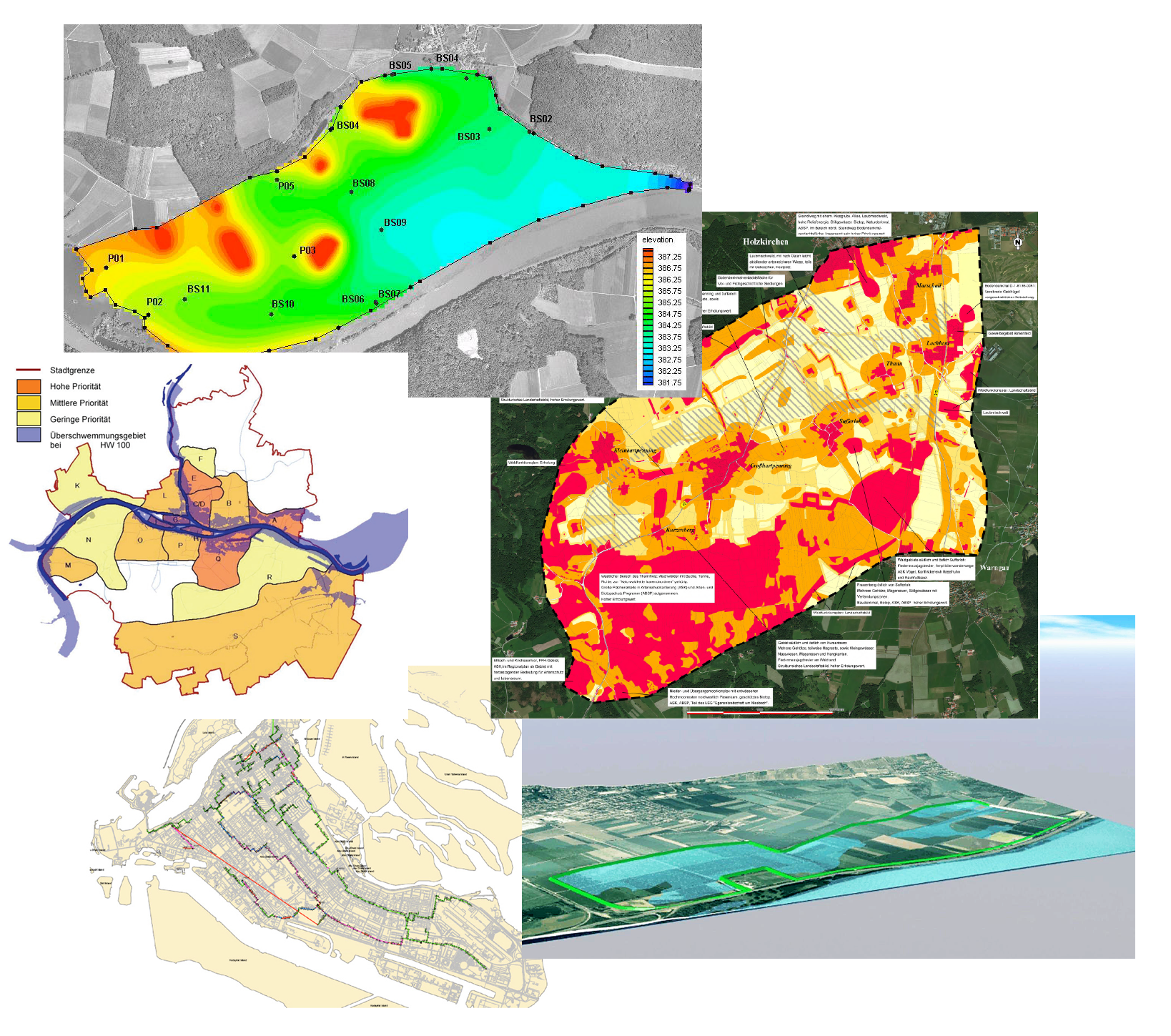
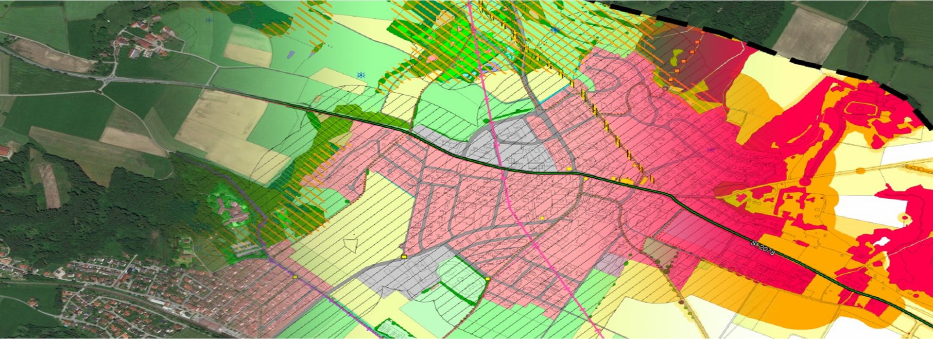
For the successful implementation of a project it is essential to establish a comprehensive information basis in the planning process. And this is exactly what you achieve using a geo-information system, where our experienced experts capture, process and analyse relevant data for each of your building projects. CAD and vector elements are linked to all possible forms of information with no limits on size or complexity. This helps to make well-founded decisions at any time.
GIS is also the basis for every BIM model. By using OGC-compliant geo-information systems, smooth data exchange between all project participants is always guaranteed. We have listed the advantages of such a BIM model for you here.
GIS – fundamental for civil engineering
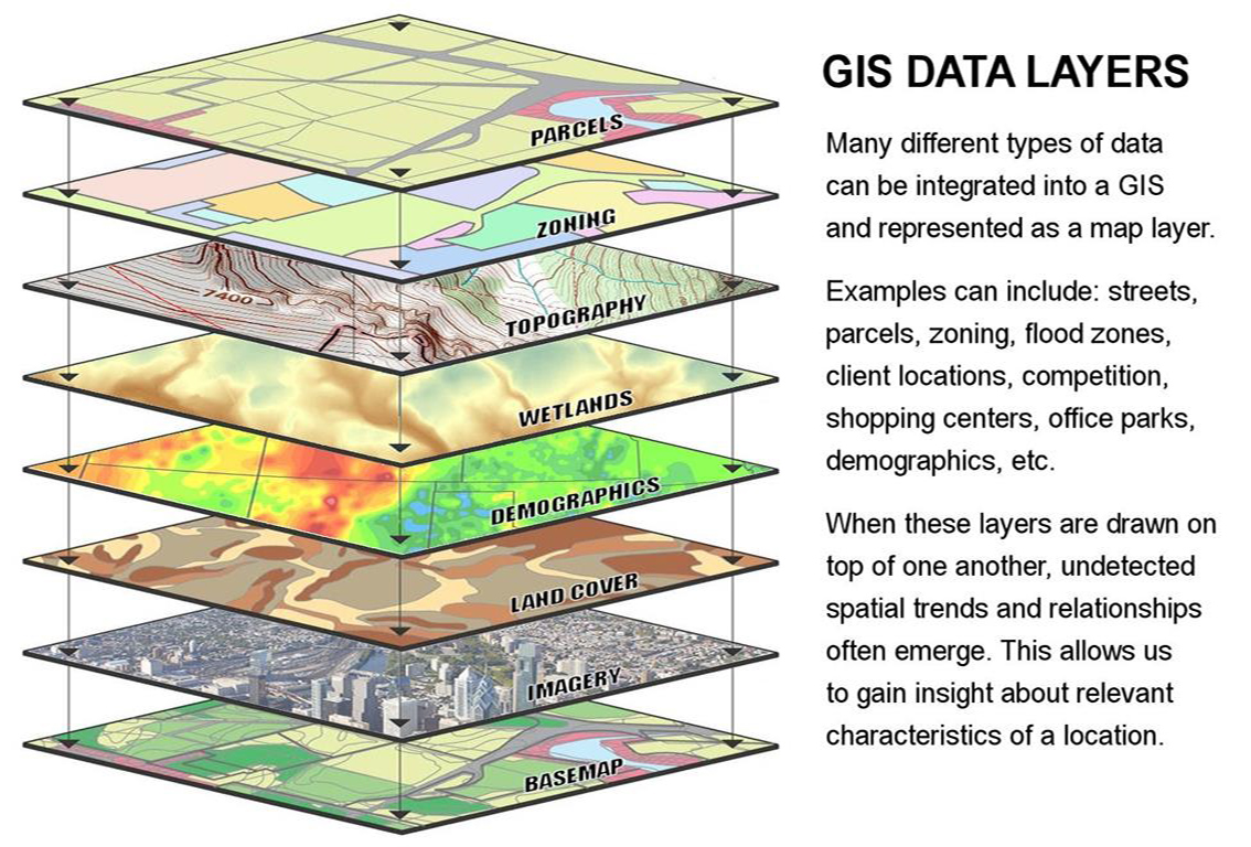
Geographic Information Systems (GIS) means that vector elements are connected with any imaginable information with no limits in size. Only with GIS it is possible to collect all the data from different sources with different coordinate reference systems (CRS) and thus create the data base, that is crucial for elaborating any projects. And not only spatial data, but also costs and dates and any further data, which is fundamental for BIM.
No BIM without GIS!
There is not one project of the Dorsch Group that isn’t mainly based on a crucial part of GIS. GIS software generally is not designed to reach only specific aims, but to serve as a toolbox for all imaginable and not imaginable issues of a project. An entirely GIS software offers furthermore the possibility of programming new features as well. Many different software solutions are used in those specialised fields. But beyond them one has to face also actual developments like BIM and ongoing Digitalisation, that require lots of data exchange between different software solutions, because all the data of the different fields need to be compatible. This is one of the big advantages of GIS and becomes more and more important as we meet new requirements that occur as lifecycle projects are carried out.